Geophysical Surveys & Analysis
SRH’s geophysical surveys empower you to detect underground risks, voids, and anomalies without excavation. We translate subsurface data into actionable insight, saving time, costs, and surprises in engineering, regulatory approvals, and construction planning.
Accreditations & Credentials
Geophysical Surveys & Analysis
SRH’s geophysical surveys empower you to detect underground risks, voids, and anomalies without excavation. We translate subsurface data into actionable insight, saving time, costs, and surprises in engineering, regulatory approvals, and construction planning.
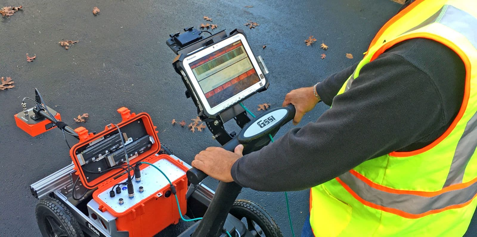
Ground-Penetrating Radar (GPR) Surveys
High-resolution, non-invasive scanning using electromagnetic pulses to detect buried utilities, voids, structural elements, and subsurface layers.
Utility Detection & Mapping
Precise location and mapping of underground electrical, water, sewer, and telecom infrastructure using GPR, EM locators, and record verification.
Subsurface Profiling & Layer Stratification
Assessment of geological layering and soil interfaces through dielectric/resistivity interpretation for informed geotechnical planning.
Depth-to-Target Determination
Identification of target depth and geometry with multi-frequency antenna arrays, providing real-time depth visualization.
Geophysical Data Acquisition & Processing
Raw data collection followed by signal correction, noise filtering, background removal, and gain balancing (e.g., GSSI Radan software).
Data Interpretation & Feature Classification
Expert radargram analysis to classify anomalies such as voids, backfills, utilities, and structural interferences.
Quality Assurance & Reporting
Compliance with acquisition protocols, antenna calibration verification, and delivery of annotated reports and recommendations.
Our Clients & Partners
Our
Services
SRH offers a full suite of advanced testing, investigation, and consulting services to support safe, compliant, and high-performance projects across Saudi Arabia.
Geotechnical Investigation
Subsurface testing and analysis to support safe foundations and site design.
Geophysical Surveys & Analysis
Non-invasive scanning to detect subsurface utilities, voids, and risks.
Materials Testing & Quality Control
Lab and field testing of construction materials for strength and compliance.
Hydrological Assessment
Water flow and flood zone analysis for drainage and sustainability planning.
Land & Topographic Surveying
Accurate mapping and site layout data for planning and construction.
Structural Integrity Assessment
Safety inspections and testing of buildings and infrastructure.
Technical Consultancy & Support
Expert guidance on design, compliance, and project approvals.
Ready to Get Started?
We’re here to support your next step. Whether you need expert consultation, a quote, or just have a quick question—reach out and we’ll respond promptly.
Let’s Start Your Project with Confidence
Frequently Asked Questions
If there are question you want to ask. We will answer all your question.
Yes. All SRH reports are fully compliant with SASO, ASTM, BS, and local municipal standards, and are prepared for direct submission to authorities and project owners across the Kingdom.
We’re built for speed. SRH can mobilise technical teams within 24–72 hours, depending on location, with real-time coordination between field and lab teams to minimise downtime.
Absolutely. SRH offers end-to-end engineering support—from foundation design reviews and drainage strategy to structural assessments and regulatory approvals—under one roof.
Simply contact us through our website, phone, or email. Our team will assess your needs and send a detailed proposal.
Stay in the Loop
Be the first to know about official announcements, service updates, and project highlights from SRH Technical Consultancy & Laboratories.